Tripolis (also known as Tripolis on the Meander) was an ancient city near the modern town of Denizli. It was situated at the intersection of three ancient regions: Phrygia, Lydia, and Caria, which is reflected in its name, which means “three cities.”
Location: Yenicekent, 20400 Buldan/Denizli – 1.5km east of Yenicekent, 22km northwest of Pamukkale.
Tripolis Ancient City – Table of Contents
Brief History of Tripolis
Pottery and chipped stone pieces unearthed at the Akyaka and Hamambükü Höyük (mounds) 2.5 km northeast of the ancient city date to the end of the Late Bronze Age (4,000-1,200 B.C.), showing evidence of early settlement in the region. In 190 B.C., with the support of Rome, the Pergamon Kingdom was victorious over the Seleucids and started governing the area in 188 B.C. At the death of Attalos III, the kingdom joined the Roman Empire.
In the Hellenistic period, the city of Tripolis flourished as it was at the crossroads of the three regions of Phrygia, Caria and Lydia – hence the name “Tri-Polis” three-city. It was founded with the name Apollonia within the Lydia region and was later known as Antoniopolis before being known as Tripolis in the 1st century B.C. Hermolaos of Tripolis was a senate in Rome during the 3rd century A.D. and would have played a significant part in the city’s development.
The city was represented by bishop Agogius of Nicea (325 A.D.), bishop Commodus of Ephesus (431 A.D.), and bishop Paulus of Chalcedon (451 A.D.). The earthquakes of 494 A.D and the Sasanid (2nd Persian Empire) raids in the 6th & 7th centuries severely affected the city. In the first half of the 13th century, the city was exchanged between the Byzantines and Turks. In 1459, the region became part of the Ottoman Empire.
The ruins mostly date from the Roman and Byzantine periods and include a theatre, baths, city walls, and a necropolis. In 2013, an ancient church dating back 1,500 years was unearthed.
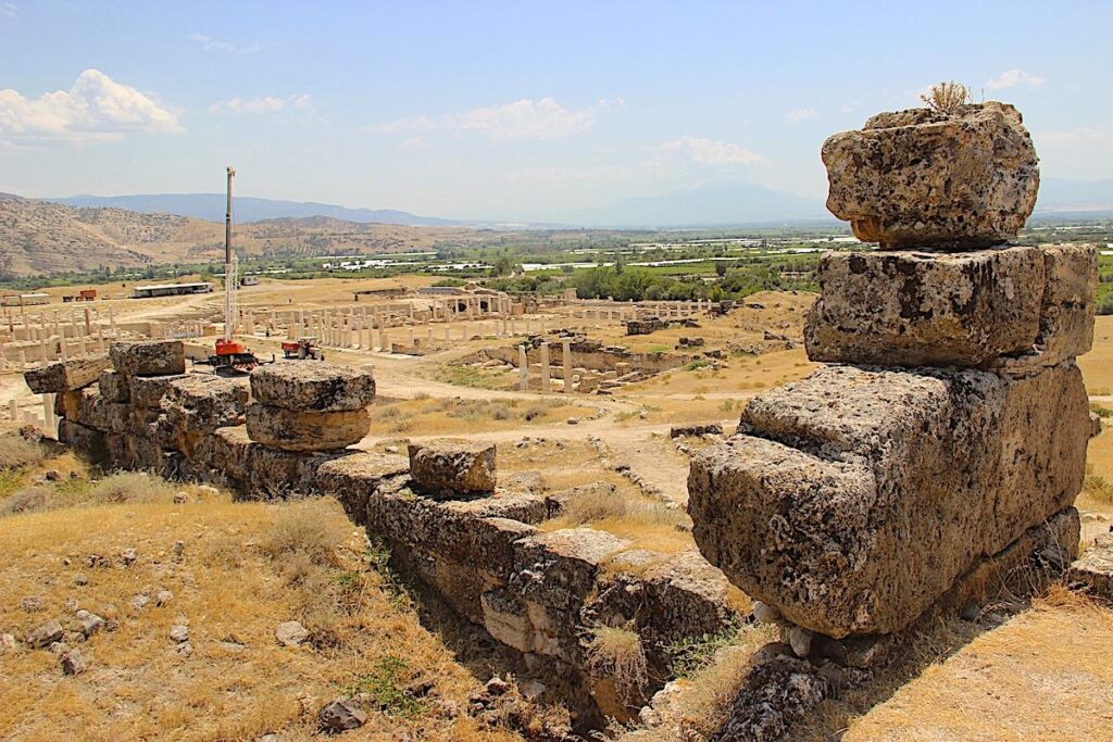
Tripolis Ancient City
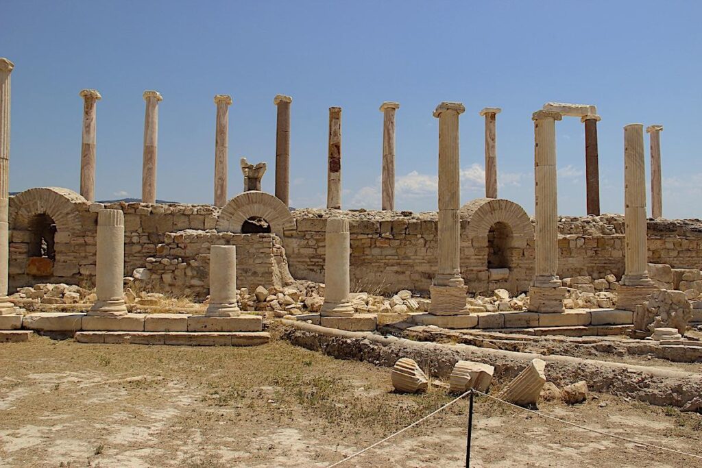
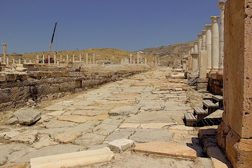
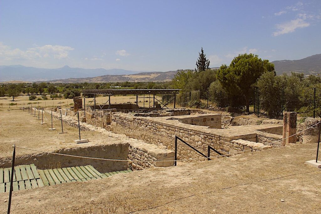
The Columned Street
The 450-metre travertine floored Columned Street in the southern part of the city runs in an east-west direction and is 10 metres wide. In the early 5th century A.D., fortification walls were built for 1.8km along the northern section, reducing the width to 7 metres. Recently excavated on the street is a 7.85-metre portico (porch entrance) with flooring consisting of multi-coloured mosaics, which would have been covered with a tiled wood-framed roof. There would have been early Byzantine shops, and six rooms are evident on the south side of the street with terracotta floor tiles and travertine slabs.
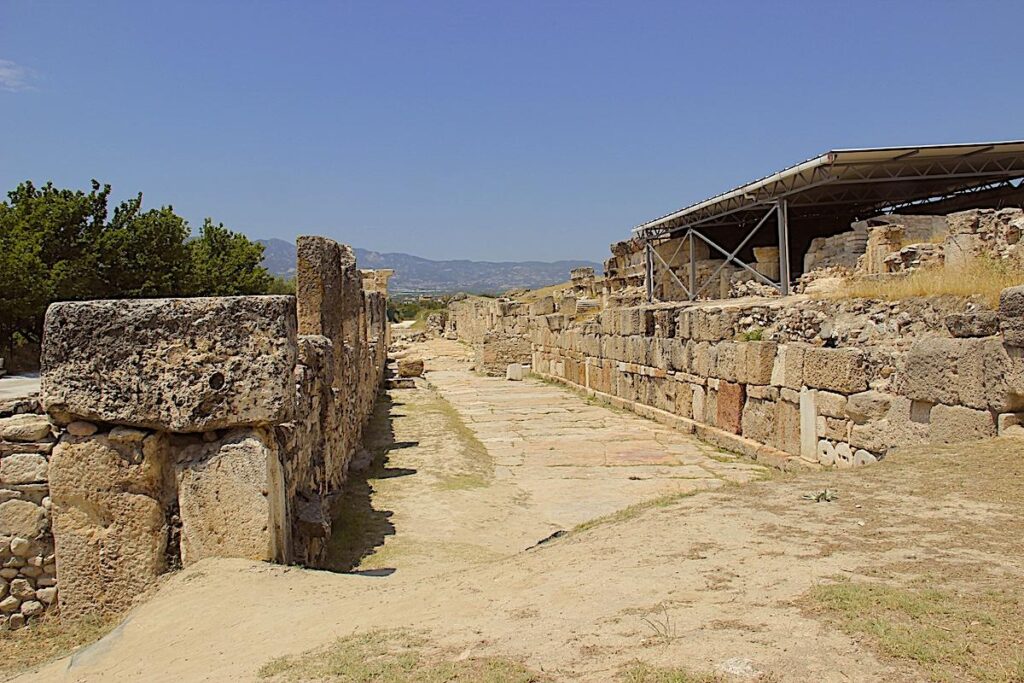
Hierapolis Street / Main Street
Running along the south-north axis from Hierapolis Gate in the south, Hierapolis Street bisects Columned Street at the Nymphaeum (Orpheus Fountain), and the streets would have been laid simultaneously. The road is 10.8 metres wide and laid with travertine blocks, covering a 1.5 metre deep, 70cm sewerage system. As with Columned Street during the Byzantine era, the section of road inside the fortification walls was reduced in size, in this case to 9.0 metres wide. Grooves can be seen in the road due to the wear of cartwheels.
The Theatre Baths
The second baths of the city were located to the southeast of the theatre and measured 59 x 44 metres. The south and west walls have survived, and an arch that belonged to the furnace and the pool in the caldarium (hot room) can be seen on the southwestern corner of the baths. The rooms of the bathes follow a sequence from north to south consisting of the caldarium (hot room), tepidarium (warm room) and frigidarium (cold room). The baths were built with travertine blocks in the 2nd century A.D.
The theatre bath cistern (water reservoir) adjacent to the southern wall of the theatre measures 10.3 by 10.9 metres. It was built with cut travertine blocks, round pebbles, and bricks. It consists of three rectangular and one square room. The passages between the rooms have vaulted ceilings. Preserved layers of plaster can be seen in patches on the walls, which have remained partially excavated.
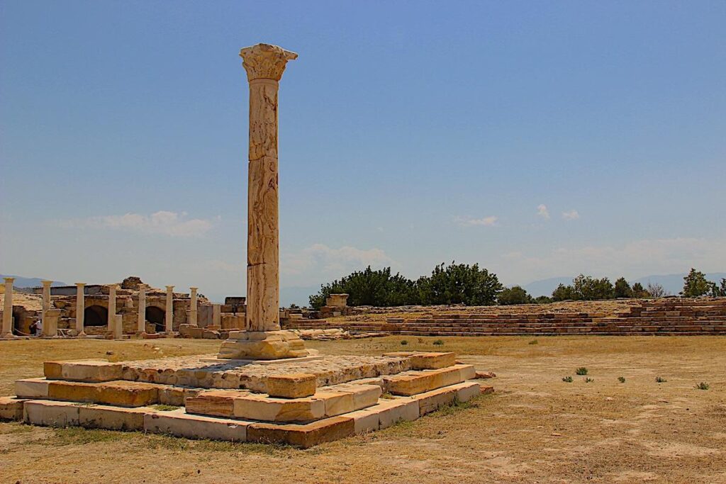
The Bouleuterion
The bouleuterion (council hall) was built close to the city centre and was constructed with cut travertine blocks. Measuring 44 by 64 metres, only some of the structure’s walls can be seen on the surface.
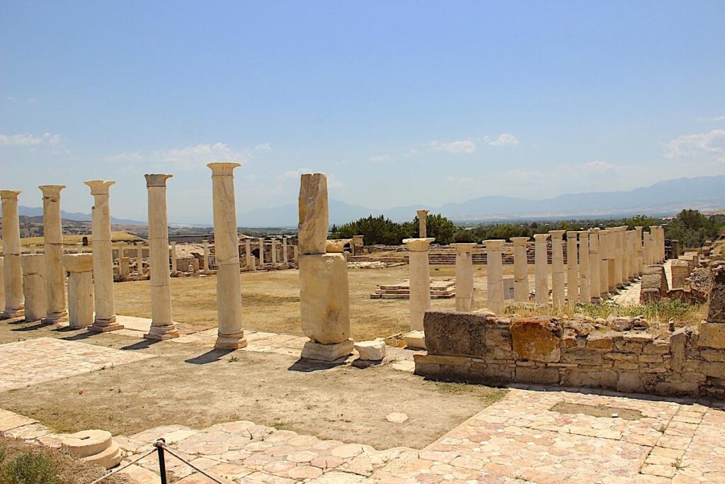
The Roman Agora
A 58-metre portion of the six-metre-wide western portico of the late Roman Agora located north of Columned Street has been unearthed. A wall running on a north-south axis confines the western side of the west portico. Originally supporting the wooden roof of the portico, 23 columns, spaced 2 metres apart and 3.5-metre-high, confine the eastern side. On the portico floor are three different types of opus sectile floor paving (inlaid into the floor to make pictures and patterns) made from onyx marble.
Between the portico and the Agora runs a sewerage system to remove rainwater and wastewater outside. An early Byzantine fortification wall confines the South of the southern portico, while the step platform for sitting confines the north. Constructed in the 4th century A.D., there are seven steps and two different platforms located on the south and north of the Angora in the form of a small stadium or arena for Agora visitors to rest.
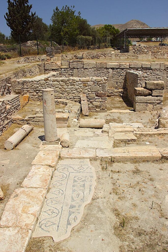
The Mosaic House
So far, a 30.6 x 10.2 metre section of the mosaic house has been unearthed. It consists of two rooms with mosaic floors, one with a lime mortar floor, one with a brick floor, a lavatory room, and a worship area. The house was initially constructed in the late Hellenistic early Roman period. The two rooms with mosaic floors were the house’s living quarters, erected in the 4th century A.D. and used throughout the 5th century A.D.
The Nymphaeum
The nymphaeum that rises on a marble podium was built on the crossroads between Columned Street and Hierapolis Street by cutting the exterior of the travertine columns located on the crossroads. The inner measurements of the nymphaeum built after Columned Street are 2.1 x 5.0 metres. The fountain’s west and north are bordered by four onyx and white marble parapet blocks.
While the parapet blocks have not been preserved on the southern side, travertine blocks survived on the eastern side. Water was carried from the reservoir located on the east of Columned Street with terracotta pipes, it was left to rest in the pool on the east of the fountain and then once again the pipes ran onto the main pool in the centre of the fountain.
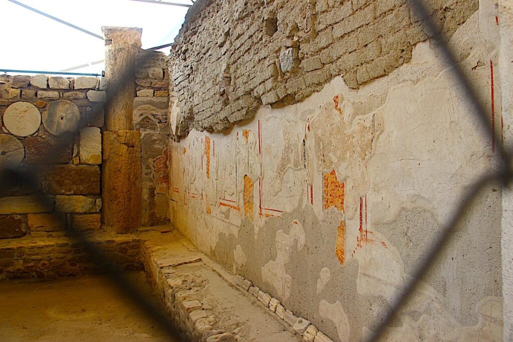
The Early Byzantine Church
The Early Byzantine Church is on the north of Byzantine fortification walls on an east-west axis. Travertine pedestals that carried the superstructure, were placed on either side of the western wall of church. The nave (central and principal part of a church) and apsis (semi-circular recess) followed the narthex (entrance or vestibule) on the west. A colourful fresco can be seen on the church’s southern wall, consisting of a prayer written in white paint over a red background.
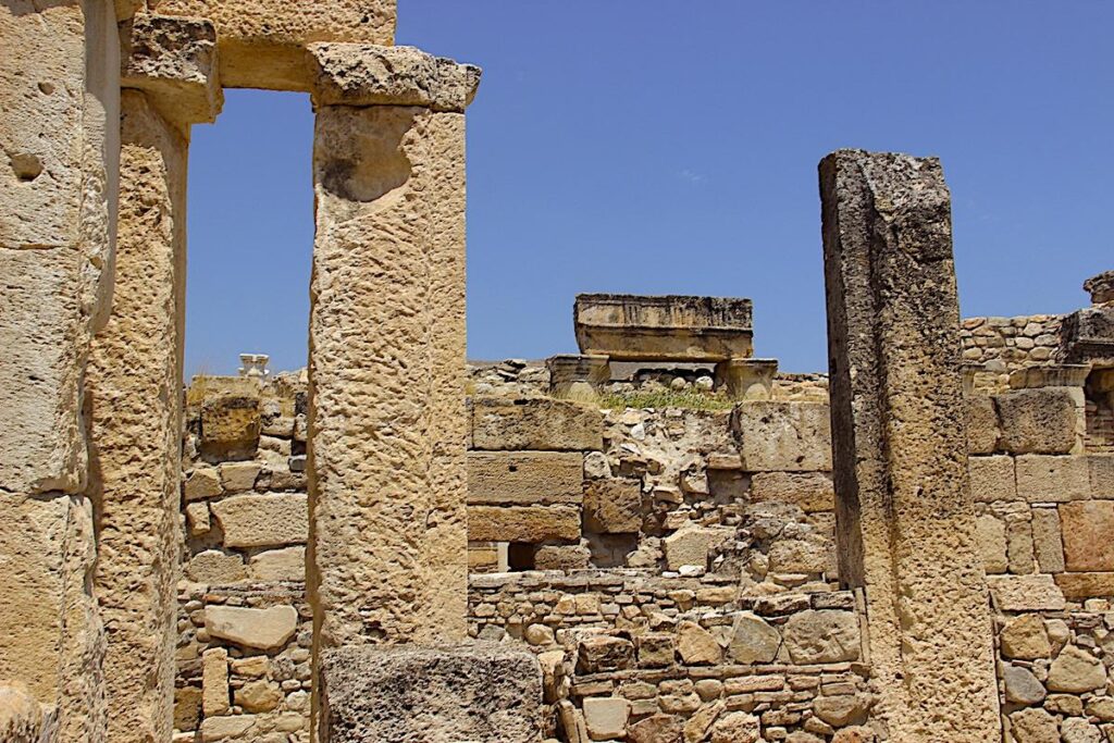
The Byzantine Fortification Walls
The Early Byzantine Fortification walls were built for defence and are 1,809 metres long. Some parts of the walls are visible on the surface. Their present height is 6.3 metres, and their width is 2.4 metres. The fortification walls were built in the late 4th century and early 5th century A.D. While both exterior services are made of travertine blocks, the interior was filled with a stone, marble, and brick filling. In addition, columns, column capitals, architrave and frieze blocks, inscribed blocks and statue bases taken from other locations were reused as building material on these walls.
The Southern Fortification Gate
The Southern Fortification Gate on Columned Street greeted visitors coming from Hierapolis. The gate has a width of 2.7 metres, is 3.0 metres thick, and is present at 3.6 metres. The street with travertine flooring was planned and built during the Roman period. In the early Byzantine period, bricks were overlaid on the travertine flooring, together with the construction of the church.
Cryptoportico (Arched Building)
Adjacent to the early Byzantine church, the cryptoportico (semi-subterranean gallery) extends on the east-west axis. Constructed in the late Hellenistic and early Roman period with a second use stage during the 4th century A.D., the cryptoportico is 10.6 metres wide and 36.4 metres long. The structure consists of 15 arches, with one side resting on the pillars in the middle and the other on the north and south walls.
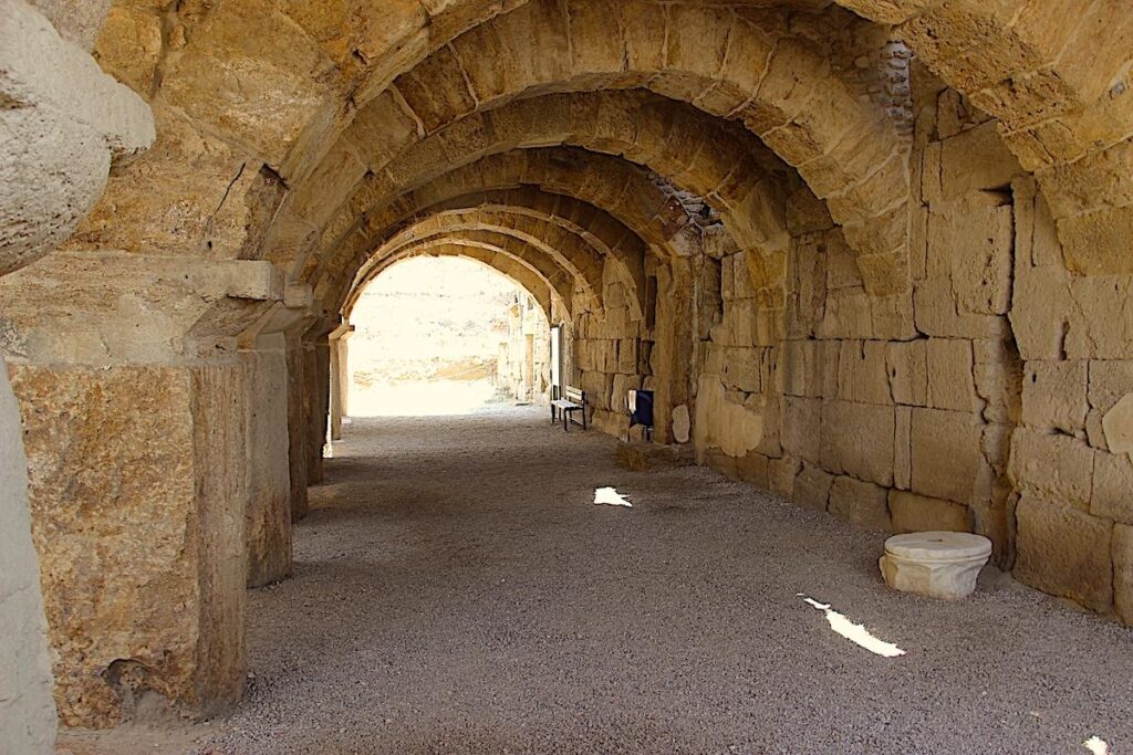
Above the arch are roof blocks made of large cut stone. Fourteen columns, twenty arches, and eighty-eight roof blocks have survived until today. Excavations on the structure revealed that the northern half contained workshops for metal, bone, and ceramic production, while the southern half was a storage area.
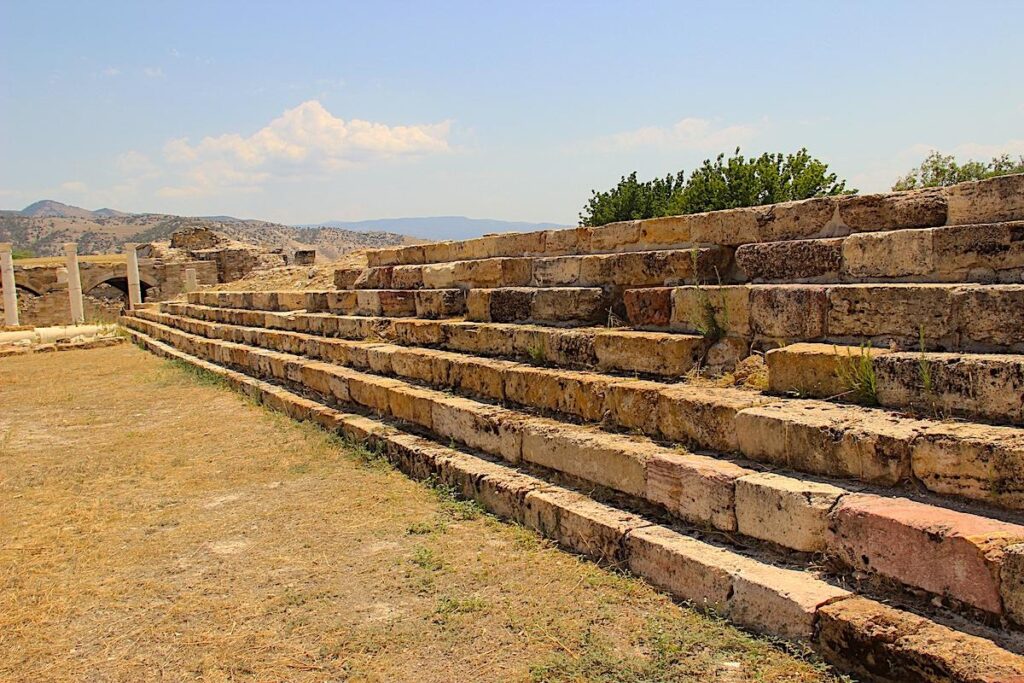
The Stadium
The stadium built in the Roman period was outside the city wall, where sporting events and cultural activities were held. It was constructed on the northwest of the city, utilising the land’s topography, with the seating area resting on the slope of the hill. The stadium measured 256 x 66 metres and was placed north-south.
A single semi-circular sphendone (the curved end of a hippodrome) can be seen to the north of the stadium; the seats on the western tribune can be partially seen on the surface, while the seats on the eastern side are mostly in ruins. The stadium track has been covered with a three-metre-deep fill; however, the seats on the stadium’s southwest corner and the orthostat (squared stone much greater in height than depth) blocks that form the border between the seats and track are still visible.
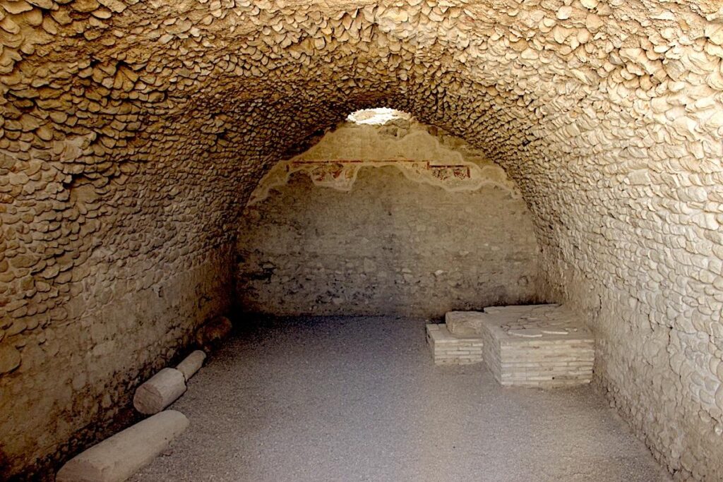
The Necropolises
There are three necropolises outside the settlement areas of Tripolis in three different directions. The burial types differ according to the topography. Most tombs are carved in the rock on the slope north of the city, and the hill’s edge is on the northwest. Sarcophagi form the majority in the northeast, whereas vaulted tombs dating to the early Byzantine period are found on the west and southeast of the city.
See also: LikeCesme.com – The Ancient Cities