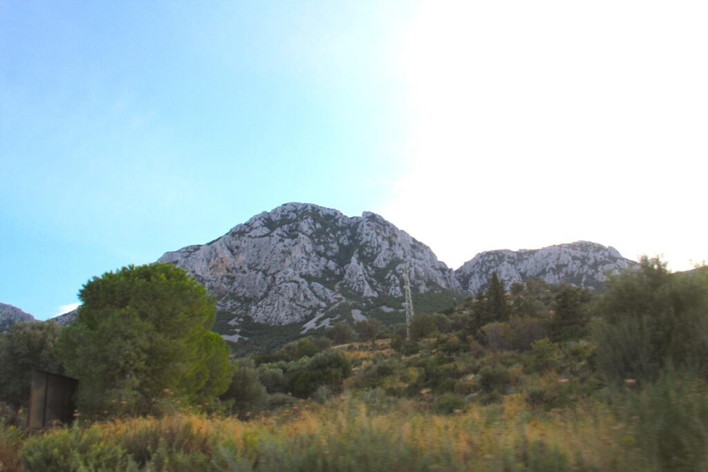
The Karaburun Peninsula (district north of Balıklıova), 35km west of Çeşme, is a visually stunning region defined by its rugged mountains, dramatic coastline, and Mediterranean flora. Its natural beauty and cultural and historical significance make it a unique destination on Türkiye’s Aegean coast. The combination of isolated beaches, traditional villages, and protected marine areas ensures that the peninsula remains a haven for nature lovers, outdoor enthusiasts, and those seeking a tranquil escape.
The Karaburun Peninsula, with its rich history and small, traditional towns and villages, offers a glimpse into the untouched beauty and slower pace of life that has largely disappeared in other parts of coastal Türkiye. Its isolation has allowed it to preserve its charm, making it a unique destination for natural beauty, history, and authenticity.
Karaburun – Table of Contents
See also: LikeCesme.com – Ildiri (Erythrai)
Geography of the Karaburun Peninsula
The Karaburun Peninsula forms the northern part of the Urla Peninsula, which extends towards the Aegean Sea and forms a large part of the west of the Anatolian Peninsula. The Çeşme district is in the south, and the Urla district is in the east. Seas surround it to the east, west and north; it is located at the entrance of the Gulf of Izmir and has an area of 415 km². The Bozdag mass, in the north-south direction of the central part of the peninsula, forms the highest part with a height of 1,212 metres at Akdağ Hill. Mountains descend perpendicular to the sea, significantly affecting the Karaburun Peninsula’s settlement. The coast of the Peninsula is 22 km from Foça, 32 km from Greece’s Lesvos Island and 24 km from Chios.
History of the Karaburun Peninsula
On the western edge of Tūrkiye, the Karaburun Peninsula has a rich history dating back to antiquity, with layers of cultural influence from various civilisations, including the Greeks, Romans, Byzantines, and Ottomans. Despite its historical significance, the peninsula has largely remained undeveloped and less visited than other Aegean regions, preserving its natural beauty and traditional lifestyle.
Like much of the Aegean coast, it was part of the Ionian civilisation during ancient Greek times. The region’s proximity to important cities like Erythrai (Ildırı) and Teos made it an integral part of the Ionian cultural and trade network. Evidence of ancient settlements and ruins remain on the peninsula, though it was not as densely populated or as prominent as nearby coastal cities. During the Hellenistic and Roman periods, they remained relatively rural and agricultural compared to larger urban centres like Smyrna (Izmir) and Ephesus. The region’s economy was primarily based on fishing, farming, and trade, especially with nearby Greek islands like Chios. During the Byzantine Empire, the peninsula remained remote and rural, though it was critical for maritime control and defence. Christianity spread through the region during this time, and several churches and religious sites were built, some of which remain in various states of preservation. Under Ottoman rule, from the 15th century, the peninsula remained sparsely populated, inhabited by a mix of Turks and Greeks focused on agriculture, mostly known for olive oil, wine production, and fishing.
The population exchange between Greece and Turkey in 1923 led to a significant demographic shift on the peninsula. During most of the 20th century, the Karaburun Peninsula remained largely isolated, with limited infrastructure development. This preserved its natural beauty and traditional way of life. In recent decades, the peninsula has become much more popular as a tourist destination, especially for those seeking a quiet and untouched part of the Aegean coast.
Karaburun Town
Location: Karaburun, İzmir
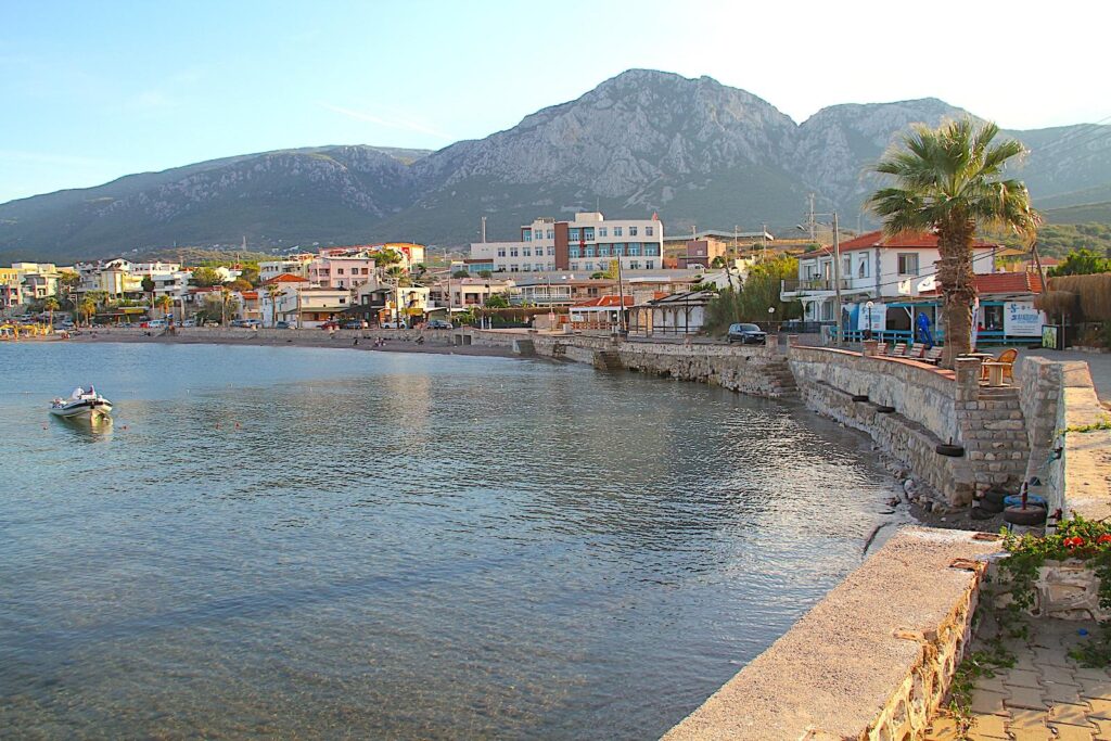
Karaburun Town, the administrative centre of the Karaburun Peninsula, is a small (population under 4,000), peaceful coastal town that exudes traditional Aegean charm. It is perfect for visitors looking for a quiet getaway surrounded by natural beauty. The town has preserved much of its authentic, rural character, with narrow streets, stone houses, and a relaxed pace of life. Its harbour, framed by fishing boats, provides picturesque sea views and nearby hills.
Mordoğan Town
Location: Mordoğan, Karaburun, İzmir
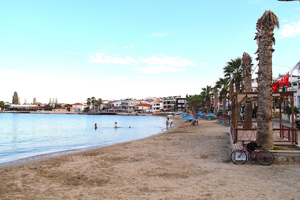
Being closer to the İzmir-Çeşme Otoyolu (O-32) and therefore more accessible than Karaburun, Mordoğan Town is the largest town on the peninsula, with a population of approximately 6,000 people, which increases significantly during the summer tourist season as a popular summer destination known for its beaches and bays. It has more tourist infrastructure than other towns and villages but remains relatively quiet outside the peak season. Its name comes from the “purple dawn” (Mordoğan) due to the stunning sunrise views over the Aegean.
Müesser Aktaş Ethnography Museum
Location: Mordoğan, 35970 Karaburun/İzmir
The Müesser Aktaş Ethnography Museum is a small but fascinating museum located in Mordoğan, dedicated to preserving and showcasing the cultural heritage of life in the region. Named after Müesser Aktaş, a passionate collector and local figure, the museum offers insight into the Aegean people’s customs, daily life, and craftsmanship. Features of the Ethnography Museum include displays of objects commonly used in the daily lives of the people of the Aegean region. This includes household items, agricultural tools, clothing, furniture, and handicrafts. Many of these items are related to traditional occupations such as olive oil production, fishing, and weaving.
Visitors can see examples of traditional carpets, kilims, and textiles, often made by local women, reflecting the region’s rich textile heritage. The intricate patterns and vibrant colours showcase the skill and creativity of local artisans. The museum features rooms set up to mimic the interiors of traditional Aegean homes to give a sense of what life was like in Karaburun in the past, with authentic furniture, kitchen utensils, and decorative objects arranged to create an immersive experience. The focus is on rural life, and the displays highlight the simplicity and resourcefulness of people living in the villages of the Karaburun Peninsula. One of the museum’s highlights is its collection of traditional clothing from the region. The intricate designs and embroidery of the women’s dresses and headscarves are particularly notable. Special attention is given to wedding attire and festive costumes, often intricately decorated and symbolically tied to the region’s culture. As a predominantly rural and agricultural area, Karaburun has a long history of farming, fishing, and olive oil production. The museum displays various tools and implements used in these traditional industries, including olive presses, grape crushers, and fishing gear.
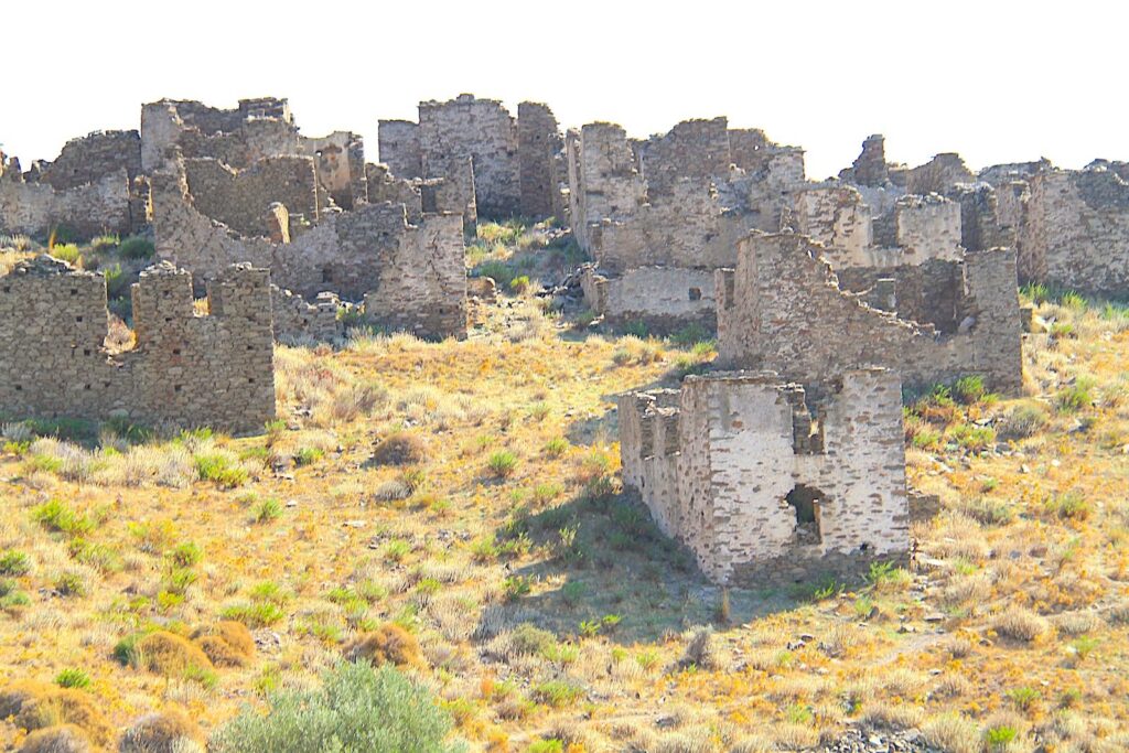
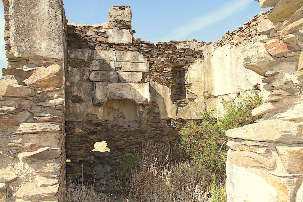
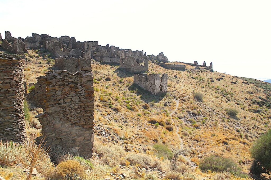
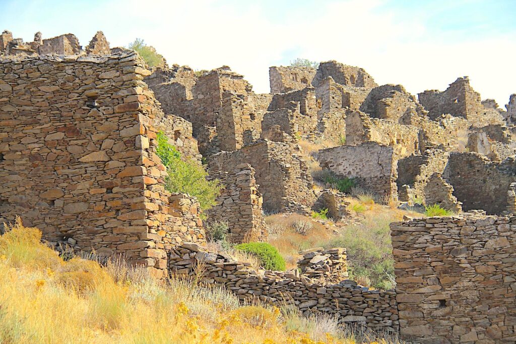
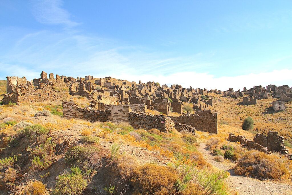
Sazak (Ghost) Village
Location: Sazak, Karaburun, İzmir
Sazak Village is a hauntingly fascinating abandoned settlement located on the rugged slopes of the Karaburun Peninsula. This ghost village, perched on a hillside overlooking the Aegean Sea, offers a unique glimpse into the region’s history, with its stone houses and cobbled streets standing as silent witnesses to a bygone era. The village’s history dates back several centuries and was a thriving community inhabited primarily by Greek Orthodox families. The economy of Sazak was traditionally based on agriculture and livestock farming, with villagers growing olives, grapes, and other crops typical of the Aegean region. During the population exchange between Greece and Turkey in 1923, following the Treaty of Lausanne, the Turkish settlers assigned to the area never fully resettled in Sazak due to its remote location, rugged terrain, and lack of resources. As a result, the village was abandoned and left to decay, remaining untouched by modern development. The once-bustling community has turned into a ghost village, with many of its traditional stone houses still standing, though in various stages of ruin.
Sarpıncık Lighthouse
Location: Sarpıncık, 35960 Karaburun, İzmir
The Sarpıncık Lighthouse is a historic maritime beacon located on the westernmost tip of the Karaburun Peninsula in Turkey, near the village of Sarpıncık. This iconic lighthouse is significant for its practical role in navigation and cultural value, symbolising the region’s maritime history. It was built in the Early 20th Century during the late Ottoman period to ensure safer passage for ships navigating the waters around the peninsula, with its rocky coast and frequent strong winds, historically treacherous for sailors. On the cliff, the edge of the peninsula, overlooking the Aegean Sea, where the waters of the Chios Strait meet the open sea. Its location strategically guides ships passing through this narrow strait, especially those heading toward Izmir or other Aegean ports.
The lighthouse has been continuously in operation since its construction, originally powered by oil lamps, but later converted to electricity. The lighthouse, with its cylindrical tower and traditional design, reflects early 20th-century Ottoman architecture for coastal infrastructure. Although it is relatively modest in size, its simplicity and location on the windswept cliffs give it a picturesque charm. Perched on a cliff, the Sarpıncık Lighthouse offers stunning panoramic views of the Aegean Sea and the nearby Greek island of Chios. It is popular during sunset, when the sky and sea merge in vibrant colours, attracting visitors and photographers who want to capture the region’s natural beauty.
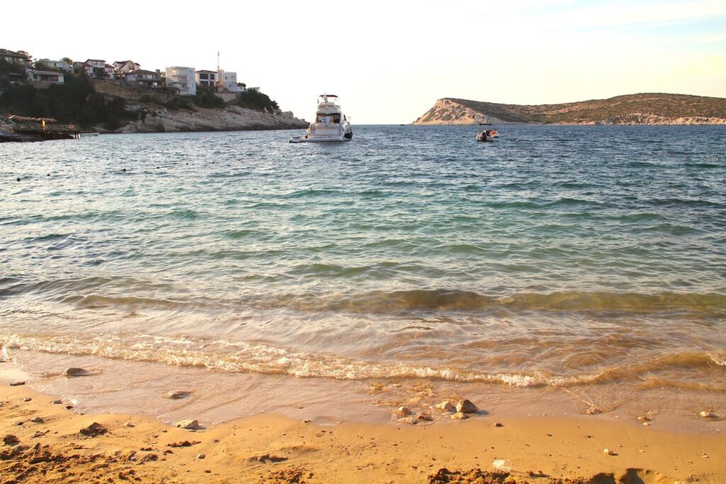
Beaches of the Karaburun Peninsula
The Karaburun Peninsula boasts some of the most pristine and unspoiled beaches in Türkiye. Known for its crystal-clear waters, rocky coves, and peaceful atmosphere, the peninsula offers a mix of rugged, secluded beaches and more accessible, sandy shores.
West Coast Beaches: The beaches on the peninsula’s west side (facing Inousses and Chios) are typically less crowded, as they are more challenging to access and further away from the towns and holiday homes, which are more prevalent on the east coast. Examples of such beaches are Küçükbahçe Plajı, Tuzla plajı and Badem Bükü near Parlak.
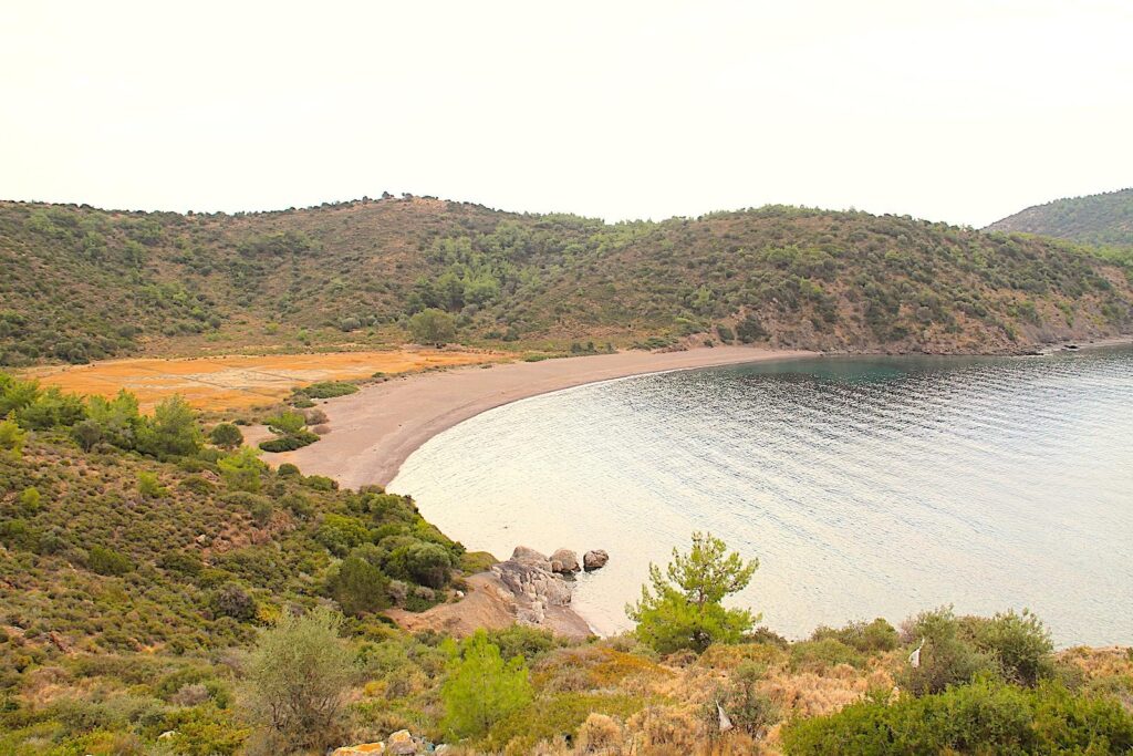
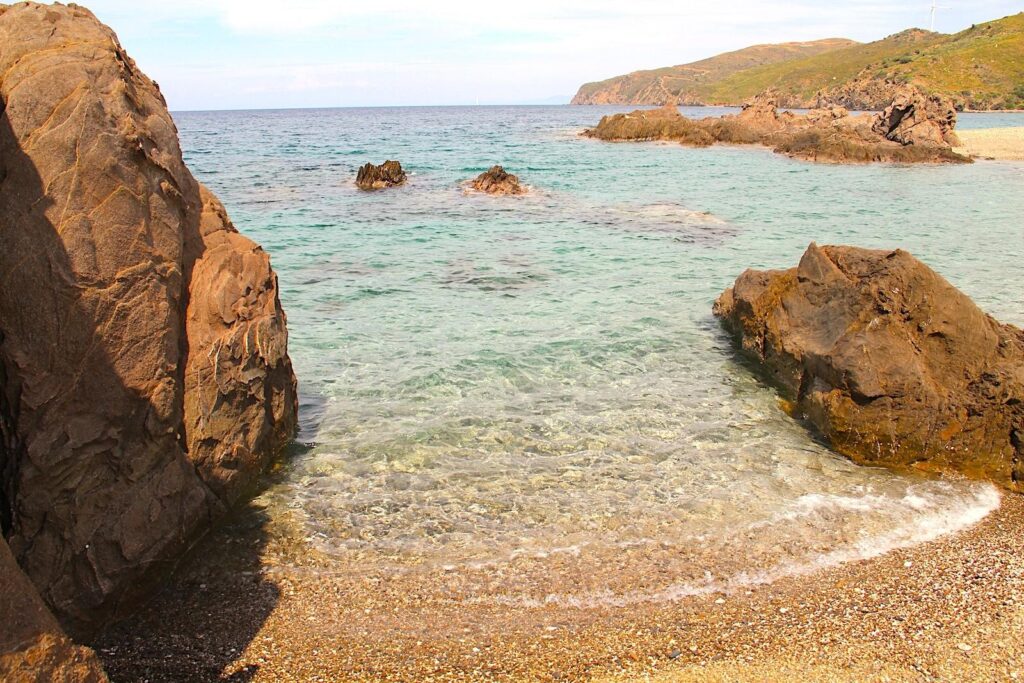
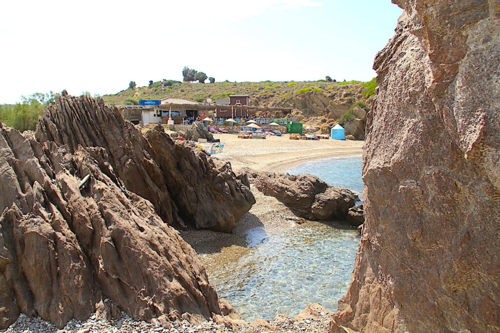
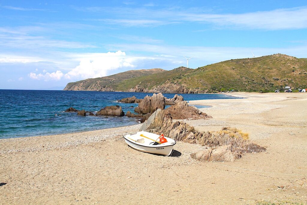
East Coast Beaches: The beaches on the peninsula’s east side (facing Foça and the Gulf of İzmir) are more popular and generally have more organised facilities. Examples of such beaches are İncirlikoy Plajı, Karaburun Bodrum Plajı and Boyabağı Koyu around Karaburun Town, and Kocakum Plajı, Ayı Balığı Koyu and Manal Koyu in and around Mordoğan.
The Mediterranean Monk Seal & Marine Protected Areas
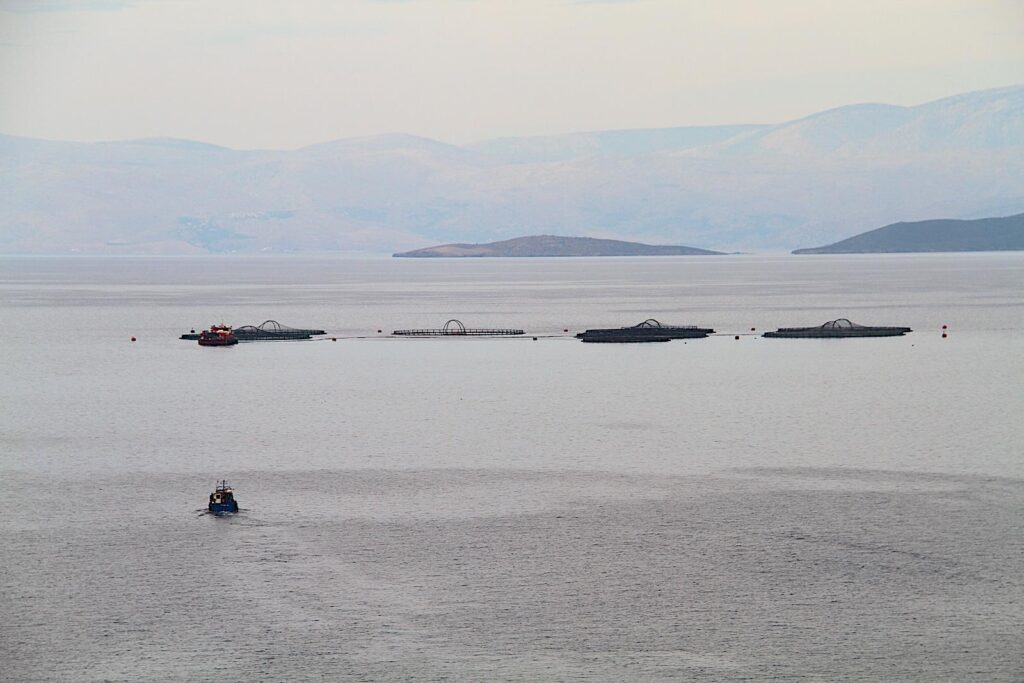
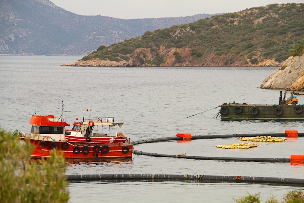
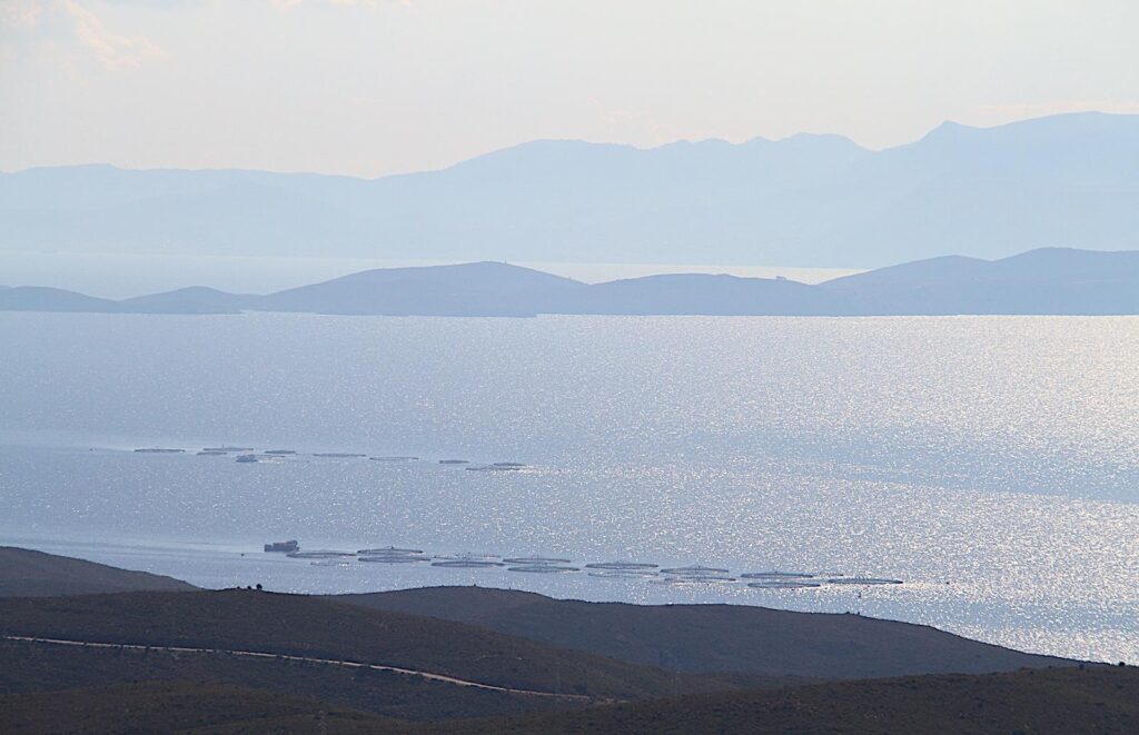
The Karaburun Peninsula is home to several marine protected areas (MPAs) critical for preserving the region’s unique marine biodiversity and ecosystems. These protected areas aim to safeguard the peninsula’s rich marine life, including vulnerable species like the endangered Mediterranean monk seal and diverse habitats such as rocky reefs, seagrass meadows, and coastal ecosystems. Specific caves and coastal areas where monk seals are known to breed are closely monitored and protected from human interference. Fishing and boating activities are regulated near these sensitive habitats to minimize disturbance. The waters off the coast of Karaburun are well-known for their high biodiversity, including various fish species, molluscs, and corals. Different species of dolphins, including Common and Bottlenose Dolphins, can be seen in the waters around Karaburun. The area provides an essential corridor for their migration and feeding.
The Foça-Karaburun-Çandarlı Bay SEPA is a crucial habitat for the Mediterranean monk seal (Monachus monachus), one of the world’s most endangered marine mammals in the world. According to the Marine Mammal Association (U.S. Government), the Mediterranean monk seal is one of two surviving species of monk seals. As with the Hawaiian monk seal, the Mediterranean species is endangered, numbering no more than 700 animals. A third species, the Caribbean monk seal, was driven to extinction in the 20th century. The waters around the Karaburun Peninsula provide safe breeding grounds for the monk seals, and the rocky coastline offers secluded caves for shelter. The protection efforts in this area focus on reducing human impacts, including pollution, overfishing, and habitat destruction. In addition to monk seals, this protected area is home to various species of fish, dolphins, and seabirds. The region also contains important underwater ecosystems like Posidonia oceanica (seagrass meadows), which serve as vital nurseries for marine life.
Karaburun Municipality
Municipality website (Turkish only)
Festivals in Karaburun
| Month | Activity | Location (Town) |
|---|---|---|
| January | Daffodil Festival | Karaburun |
| February | Sea Bass Competition | Mordoğan |
| 5-6 May | Hıdırellez (Ederlezi) Festival | Mordoğan |
| May | Youth Gathering | Karaburun |
| June | Youth Gathering | Mordoğan |
| June | Sheep Shearing Festival | Karaburun |
| August | Grape Festival | Kösedere |
| September | Borluce Culture & Art | Karaburun |
| 16 September | Liberation of Mordoğan | Mordoğan |
| 17 September | Liberation of Karaburun | Karaburun |
| November | Furma Olive Festival | Eğlenhoca |
| November | Tangerine Festival | Kūçükbahçe |