The Izmir public transport system includes metro, tram, buses, ferries, and suburban rail. The city’s transport network is managed by several operators under the coordination of the İzmir Metropolitan Municipality, with the unified payment system “İzmirim Kart” simplifying transfers across different modes of transport.
The Metro line runs from Fahrettin Altay in the west to Evka 3 in the east, covering key residential and commercial zones. Tram lines serve coastal neighbourhoods with two separate routes: Konak Tram and Karşıyaka Tram, which are particularly scenic and worthwhile for travellers. The bus network, operated by ESHOT, covers virtually all neighbourhoods in the city and outlying districts. Buses are frequent and reliable, though some routes may be crowded during peak hours.
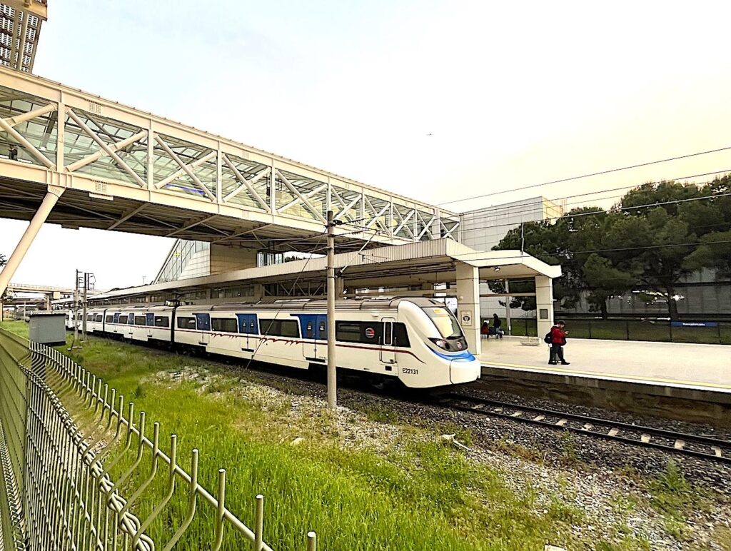
For longer distances and airport connections, İZBAN: Izmir’s commuter train system serves as a fast and modern option, connecting Aliağa in the north to Selçuk in the south, stopping at Adnan Menderes Airport along the way. Ferries operated by İzdeniz offer pleasant and efficient crossings of the Gulf of Izmir, with terminals in Konak, Karşıyaka, Bostanlı, and others. These ferries save time and provide panoramic views of the city.
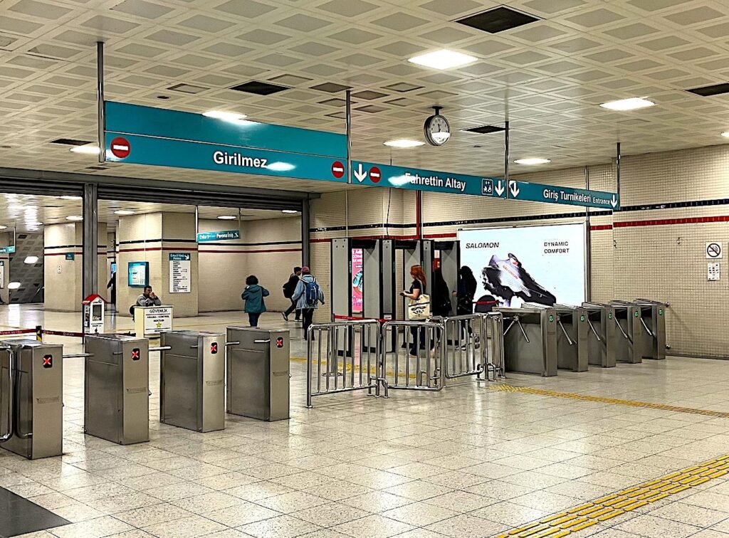
For tourists arriving from Çeşme on the Çeşme Seyahat Coach, the most convenient connection to the Izmir Public Transport system is via Fahrettin Altay, which directly links to the metro and tram lines. On arrival at Fahrettin Altay, the Çeşme Seyahat Coach stops directly above the metro stairs and across Fahrettin Altay Meydan (Square) from the Konak Tram Line (which can be accessed by the metro underpass). On departure from Izmir to Çeşme, the coach station is Fahrettin Altay Bus Depot in the park in front of İstinyePark İzmir shopping mall.
Izmir Public Transport – Table of Contents
Metro İzmir – Izmir Public Transport Metro System
Metro İzmir Website (Turkish Only) Timetable & Frequencies – Typically operates 06:00-00:00
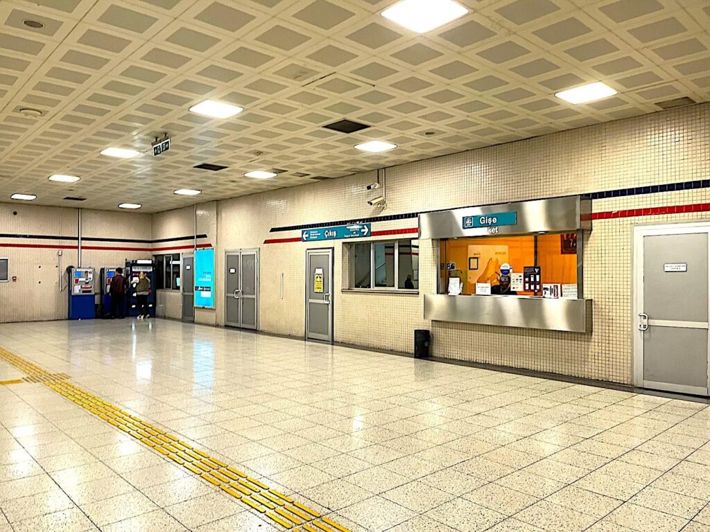
The İzmir Metro is a rapid transit line that forms the backbone of the city’s urban rail system; It covers central districts such as Bornova, Konak, and Balçova. The M1 line, spanning from Evka 3 in the northeast to Narlıdere Kaymakamlık in the southwest, covers a distance of approximately 27 kilometres and includes 24 stations. A complete journey along this route typically takes about 47 minutes.
The metro is modern, air-conditioned, and generally runs from 06:00 until 00:00 (extended hours on weekends) with frequent intervals of 3-7 minutes during peak hours. Stations are equipped with elevators and escalators, and signage is often bilingual (Turkish and English), making navigation straightforward for tourists. Major interchange points, like Halkapınar, connect the metro to other systems like İZBAN and tram lines, providing smooth transfers.
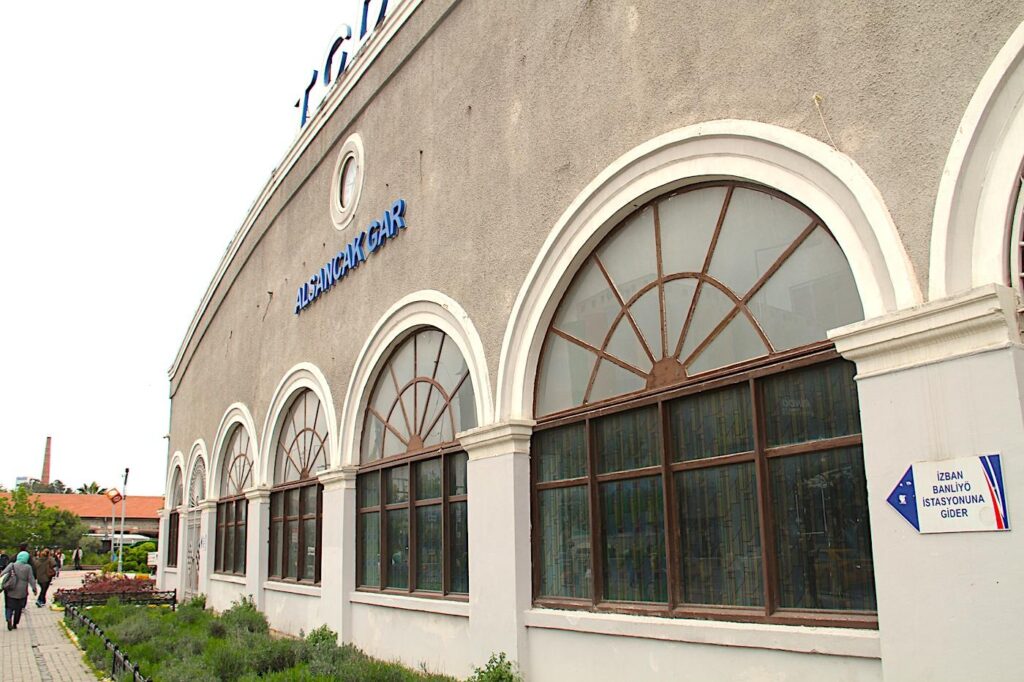
The metro is a popular choice for commuters due to its speed and reliability, particularly when compared to road-based alternatives that may be affected by traffic. While the current system has a single main line, expansion projects are underway to add new lines and extend coverage. The metro can significantly cut travel time to suburban attractions or transportation hubs for tourists accessing central districts like Alsancak and Konak.
Tram İzmir – Izmir Public Transport Tram System
Tram İzmir Website (Turkish Only) Timetable & Frequencies – Typically operates 06:00-00:00
Izmir’s tram system consists of two main lines: the Konak Tram and the Karşıyaka Tram. The Konak Tram runs along the southern shoreline of the Gulf of İzmir, connecting key points such as Halkapınar, Alsancak, Konak Square, and Fahrettin Altay. It’s ideal for tourists exploring the scenic waterfront, visiting cultural attractions, or hopping between neighbourhoods along the coast. The Karşıyaka Tram, located on the northern side of the gulf, connects Mavişehir to Alaybey, mainly serving residential and commercial areas but also providing access to parks and local shopping districts.
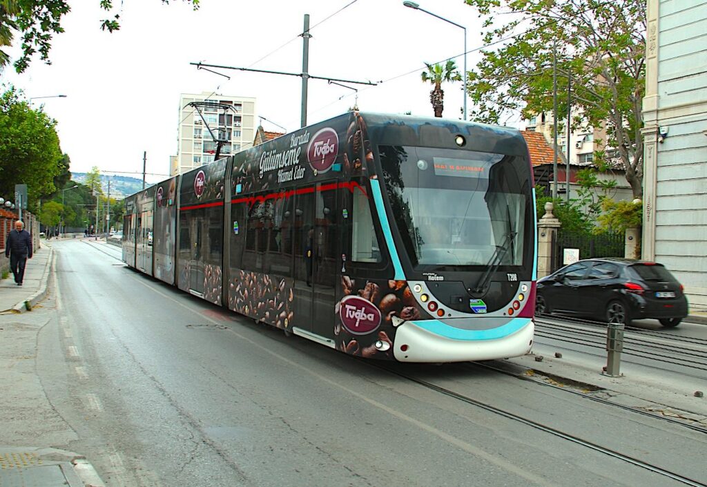

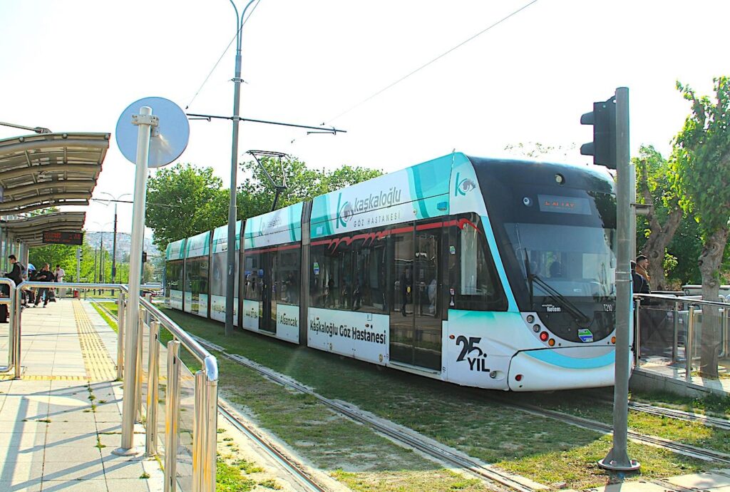
Trams are sleek, low-floor vehicles that simplify boarding, especially for passengers with strollers, luggage, or mobility issues. They run frequently and on dedicated tracks, making them both efficient and pleasant to ride. Since both tram lines intersect with other transport systems like the metro, İZBAN, and ferries at several points (notably at Halkapınar and Karşıyaka terminals), they are often used in combination with other modes for a seamless travel experience. Tourists enjoy the trams for their convenience and the scenic, leisurely views they offer along the coastline.
ESHOT – Izmir Public Transport Bus System
İzmir’s bus system, operated by ESHOT, is the most extensive component of the city’s public transport network, reaching virtually every district and neighbourhood. With hundreds of routes, buses connect central locations to suburban and rural areas and the airport. Buses run frequently, especially during rush hours, and are generally punctual. Most buses are modern and equipped with air-conditioning and digital route displays. Major transfer hubs include Konak, Üçyol, and Bornova, where multiple routes converge.
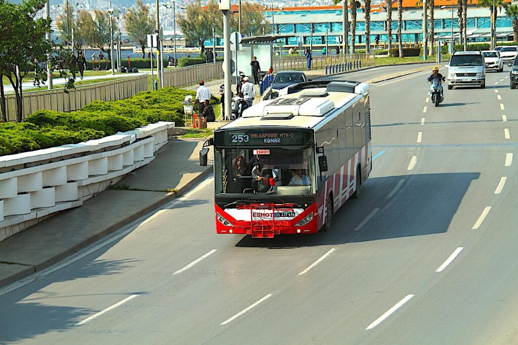
For tourists, buses are useful for reaching destinations not served by rail, such as Kadifekale Fortress, Izmir Şehirlerarası Bus Terminal or Fuar İzmir. However, they can be slower than other modes due to traffic congestion, especially during peak hours. Using an İzmirim Kart makes boarding quick and easy, and digital displays at stops often show real-time arrival information. It’s also worth noting that many buses operate late into the evening, but night service is limited. Route planning apps or station staff can help choose the correct line for those unfamiliar with the city.
İzdeniz – Izmir Public Transport Ferry System
İzmir’s ferry system, managed by İzdeniz, provides a scenic and practical way to cross the Gulf of İzmir, connecting the city’s northern and southern shores. Ferries link terminals such as Konak, Alsancak, Karşıyaka, Bostanlı, Pasaport, and Üçkuyular, offering both commuter convenience and picturesque views. Services run from early morning until late evening, with frequent departures, especially during rush hours. For visitors, ferry rides offer a relaxing break from city traffic and an excellent opportunity to enjoy the coastline from the water.
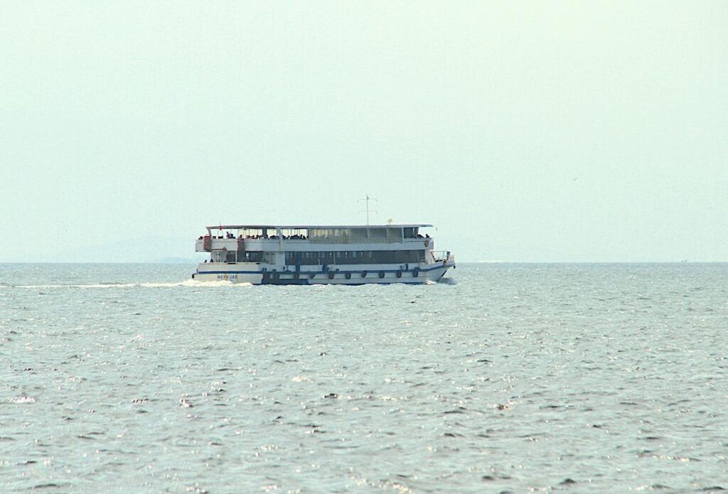


The vessels are spacious and clean, with indoor and outdoor seating areas. Many locals use ferries daily, especially between Karşıyaka or Bostanlı on the north shore and Konak or Alsancak on the south. The Üçkuyular to Bostanlı ferry is equipped to carry cars and facilitates travel to areas northeast of İzmir, such as Çiğli Bird Paradise, Foça and Pergamon Ancient City (Bergama) and bypasses the traffic of İzmir town centre. They are ideal for tourists wanting to see different parts of the city in comfort, or as part of a sunset itinerary. Bicycles are allowed on board, which can help explore neighbourhoods after docking. İzmirim Kart is accepted, and fares are the same as other public transport, making ferries affordable and enjoyable.
İZBAN – Izmir Public Transport Suburban Rail System
İZBAN is a high-capacity suburban rail system that connects İzmir with outlying districts and towns, stretching over 130 kilometres from Aliağa in the north to Selçuk in the south. It is vital for those travelling long distances, including to and from Adnan Menderes Airport, which has a dedicated station. The line shares tracks with the national railway but operates like a modern commuter train, with air-conditioned cars, digital displays, and frequent service during the day. Key interchange stations like Hilal and Halkapınar allow passengers to easily transfer to the metro or tram.
For tourists, İZBAN is a convenient way to reach destinations outside the city centre, including historic sites like Selçuk (near Ephesus Ancient City) or beaches near Foça (via additional local transport). It is faster than coaches for longer distances and provides a comfortable, reliable ride. Stations are well-marked, and many have elevators and ramps. Like other transit systems in İzmir, İZBAN accepts the İzmirim Kart, streamlining ticketing across the network. It’s a valuable tool for travellers who want to explore beyond the urban core without renting a car.
İzmirim Kart – Izmir Public Transport Unified Payment System
Official İzmirim Kart Website (Turkish Only) –
Tourists will find the İzmirim Kart essential for seamless travel. The card can be purchased and recharged at kiosks, metro stations, and many convenience stores. It is valid on all forms of public transport, and transfers between buses, metro, tram, and ferries within 90 minutes are typically free or discounted. Signage in public transport hubs is relatively straightforward, and major stops often have information in both Turkish and English. Still, it’s helpful to use navigation apps like Moovit or Google Maps, which are well-integrated with Izmir’s system.
While Izmir’s public transport is modern and safe, it can be crowded during weekday mornings and evenings. The city near the Bay of Izmir is mainly flat, making walking and cycling attractive options, especially in central areas like Alsancak, Konak, and Kordon. Ferries are a great way to relax and enjoy the sea breeze while travelling. Most public transport services run until late evening, but if you’re staying out past midnight, you may need to rely on taxis or walking, as night buses are limited.
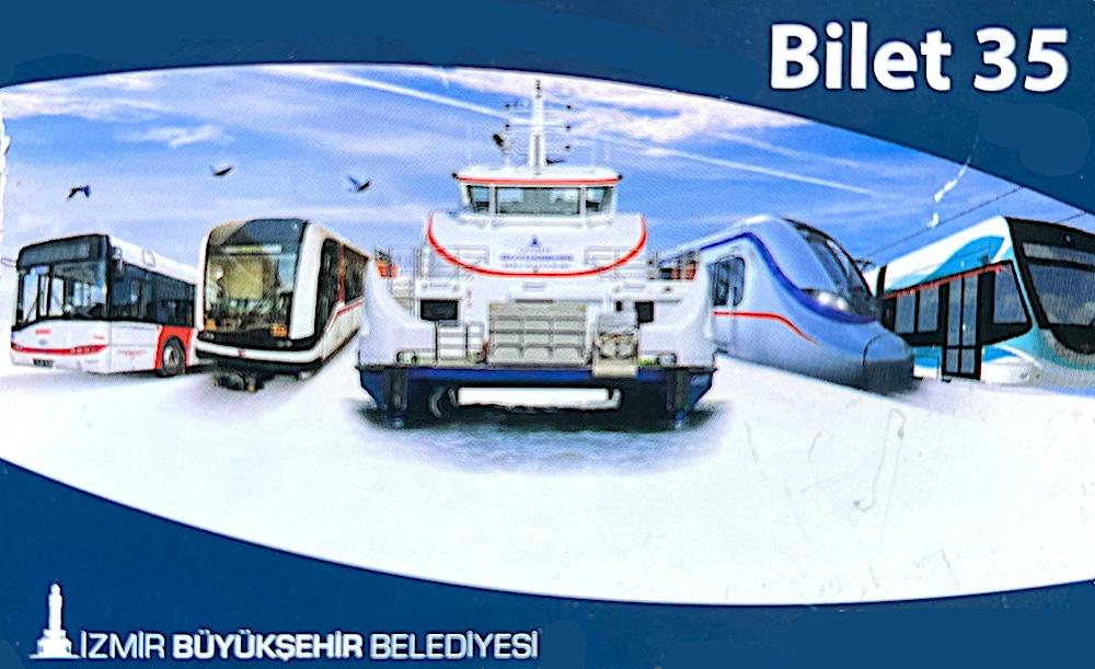
As of May 2025, the prices for a single journey on the metro, tram, ferry, and most buses are the Turkish Lira equivalent of €0.60; for airport buses, the price is approximately €1.30. The maximum price of the İZBAN for the 130km journey from/to Aliağa and Selçuk is the Turkish Lira equivalent of €2.65. To purchase a refillable İzmirim Kart is €3.20 without credit; otherwise, “Bilet 35” multiple credit tickets are: x2, approx. €2.30, x3, approx. €3.30, x5, approx. €5.20, x10, approx. €8.90. Bilet 35 credit tickets are so-called as they are valid for 35 days from first use.
All prices above are indicative only. They are subject to frequent inflation price rises and the exchange rate fluctuation between the Turkish Lira and Euro.
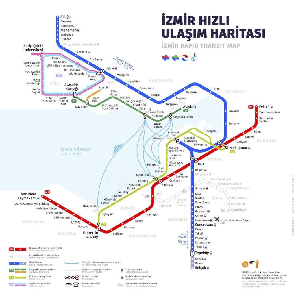
Izmir Public Transport Maps
Below is the adapted official city map highlighting the key stops:
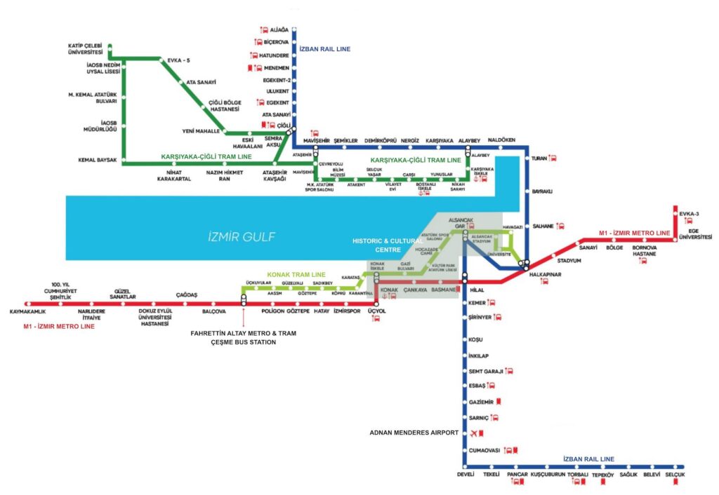
A very high-quality Izmir Public Transport Tram System Map, which is easy to understand and integrates the key metro, train and tram lines, plus İzmir ferries, has been developed by Evgeny Katyshev. To download a fully scaled version in .pdf or .png (for non-commercial purposes) from his website in English, Turkish or Russian, click here.